विशेष लेख
The evolution of a Digital Earth
In 1998, Al Gore delivered his widely cited speech, The Digital Earth: Understanding Our Planet in the 21st Century. In it, he outlined a vision for a transformative approach to Earth science, communication, and society.
Julian Cross
लेखक
लेख परिचय
नीचे पूरा लेख पढ़ें।
अनुभाग
समाचार

In 1998, Al Gore delivered his widely cited speech, The Digital Earth: Understanding Our Planet in the 21st Century. In it, he outlined a vision for a transformative approach to Earth science, communication, and society.
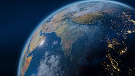
Gore imagined technology that could “capture, store, process, and display an unprecedented volume of information about our planet and a wide range of environmental and cultural phenomena.” Looking at today’s hyper-connected, geospatially aware world, his foresight was remarkable, though his original description now seems somewhat elaborate:“Picture a young child visiting a Digital Earth exhibit at a local museum. Wearing a head-mounted display, she sees the Earth from space. Using a data glove, she zooms in through increasingly detailed layers—first continents, then regions, nations, cities, and eventually individual homes, trees, and other human-made or natural features. Once she finds an area of interest, she embarks on a ‘magic carpet ride’ through a 3-D representation of the terrain.”
Gore noted:“Although this may sound like science fiction, most of the technologies necessary to build a Digital Earth either exist today or are under development. Naturally, the capabilities will evolve over time. What we could achieve in 2005 would appear primitive compared to the Digital Earth of 2020. Back in 1998, the key enabling technologies included Computational Science, Mass Storage, Satellite Imagery, Broadband Networks, Interoperability, and Metadata.”
He also recognized the ongoing need for advancement:“Further progress is essential to unlock the full potential of the Digital Earth, particularly in areas such as automatic interpretation of imagery, combining data from multiple sources, and intelligent agents capable of locating and connecting information on the Web about a specific location. Yet, enough components are already in place to justify pursuing this exciting initiative.”
Modern Examples and Evolution
Since Gore’s speech, technology has advanced dramatically. Today, there are numerous virtual globe platforms that allow for immersive data exploration. Examples include Google Earth, NASA’s WorldWind, ESRI ArcGIS Explorer, Bing Maps 3D, TerraExplorer, and Marble. These tools are further brought to life through projects like NOAA’s Science on a Sphere.
However, the contemporary vision of the Digital Earth goes far beyond simple 3-D visualization. Today, it integrates analytics, computational expertise, and problem-solving capabilities that often span multiple disciplines and large-scale challenges. Sensor networks, volunteered geographic information, and crowdsourced data (the geoweb) play a far greater role than was imagined in 1998.
Notable modern implementations reflecting this multi-disciplinary Digital Earth include Google Earth Engine (and its forest loss monitoring tools), NASA Earth Exchange, and the HOLOS platform. These systems combine massive datasets, advanced computation, and real-time environmental monitoring to deliver actionable insights that support both scientific research and global decision-making.
In short, the Digital Earth has evolved from a visionary concept into a practical, multi-faceted reality—merging immersive visualization, big data analytics, and cross-disciplinary expertise to better understand and manage our planet.
यह भी पढ़ें

बॉटलनोज़ डॉल्फ़िन: समुद्र के हमारे स्मार्ट, मिलनसार सितारे
लेखा

Learn to Draw Birds
Zoe Parker

हेनरी दि नेविगेटर और अन्वेषण का युग
क्लो एलिज़ाबेथ

The Trendiest Earrings You Absolutely Must Have
Jack Hunter

डंडेलियन के लाभ: पोषण, एंटीऑक्सीडेंट और सूजन
ऋषि
चाँद पर हमारे पहले पदचिह्न बनाए हुए 47 साल हो गए हैं — यहाँ वह बातें हैं जो आप पृथ्वी के धूल भरे साथी के बारे में नहीं जानते होंगे
सिद्धार्थ